
A few light rain showers will move through this evening, with scattered showers overnight as a cold front moves through. A few wet snowflakes may mix in, but there will not be any snow accumulation. Lows drop to around 30-degrees and winds remain gusty.
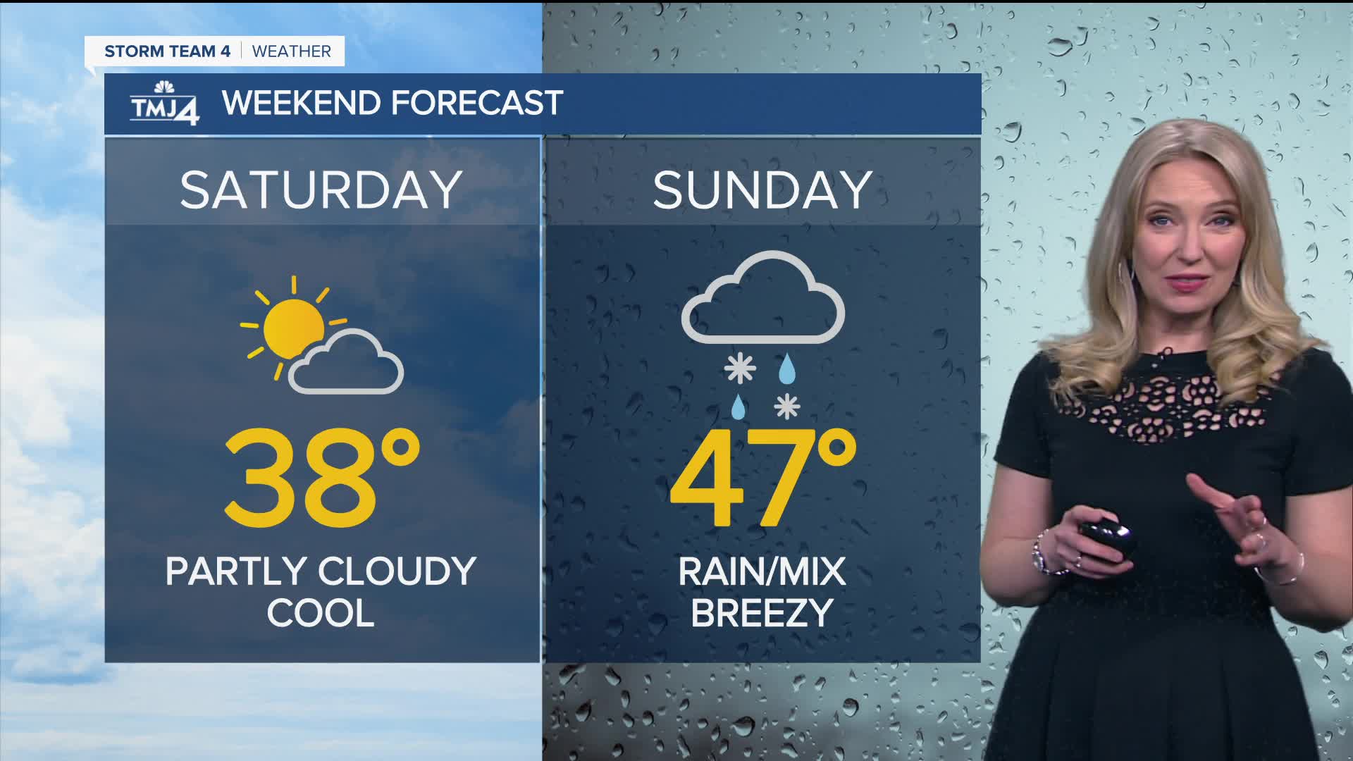
Saturday will be cool, with highs in the upper 30s to low 40s. We start the day with some clouds, but those clouds will move out through mid-day.
Watch to find out who could dodge some rain late this evening:
By Sunday, a low-pressure system will approach Wisconsin. This will bring rain showers from late Sunday morning through Sunday afternoon. By evening, rain will turn to a wintry mix, with some light accumulations possible north of Milwaukee. Highs will be in the 40s and winds will be breezy.
Monday is mostly cloudy, windy, and near average with temps in the mid 40s. Highs will remain near seasonal norms most of next week.
Highs remain in the 40s next week.
TONIGHT: Scattered Rain/Iso. Snow Flurry; Cloudy & Breezy
Low: 30
Wind: NW 10-15 G 25 mph
SATURDAY: Early Clouds; Increasing Sunshine
High: 38
Wind: NW/E 5-15 mph
SUNDAY: Cloudy, Rainy/Sct. Snow, Breezy
High: 47
MONDAY: Mainly Cloudy, Windy
High: 45
TUESDAY: Chance Rain
High: 44
WEDNESDAY: Partly Cloudy
High: 48
It’s about time to watch on your time. Stream local news and weather 24/7 by searching for “TMJ4” on your device.
Available for download on Roku, Apple TV, Amazon Fire TV, and more.
