
With lighter winds, the 40s and sunshine felt much nicer. Quiet weather continues tonight with mainly clear skies and lows ranging from the lower 30s lakeside to the middle 20s inland. High pressure brings us another beautiful early spring day tomorrow before big changes on Friday.
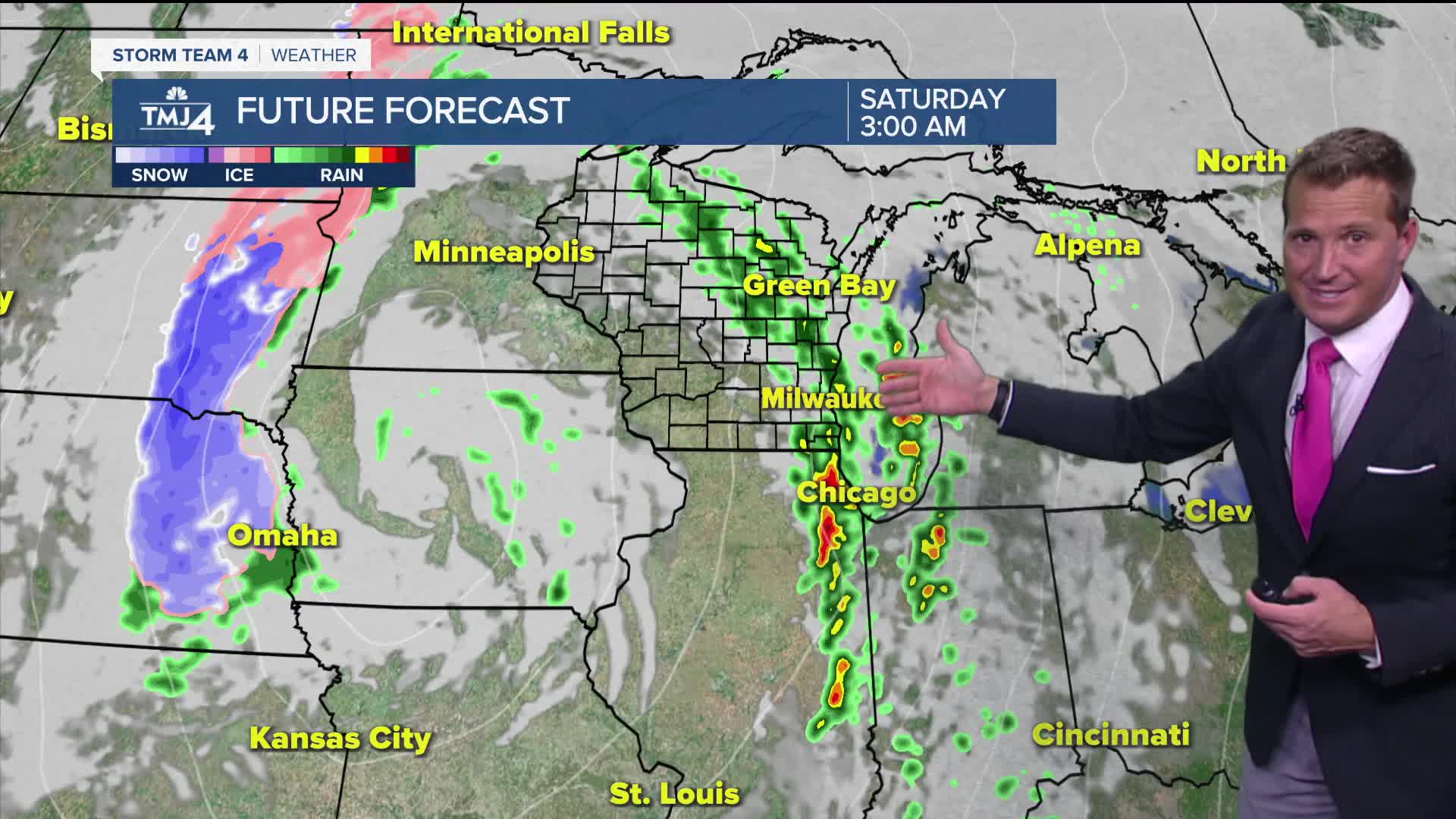
We are watching a strong area of low pressure that will eject out of the Rockies tomorrow. Warm air will surge ahead of this intensifying system on Friday. We should reach the 60s, and maybe even 70 inland. A line of rain and storms likely moves through the area Friday night. The lake and overnight timing should minimize the severe threat, but we'll have to monitor things closely. Very windy conditions and scattered showers continue into Saturday.
Watch: When we make it back to the 60s:
Mostly sunny skies for Thursday with highs near 50 by the lake and close to 60 inland. Winds will pick up out of the south on Friday as a strong low pressure develops to our southwest. A very warm day for this time of year, highs will be in the low 60s near to lake and near 70 inland. Storms will fire up across Iowa in the afternoon and evening which will eventually arrive here late in the night into the early morning hours. The best chance for a severe storm will be to our southwest but still can not rule out a strong to severe storm for us.
Windy and turning cooler through the weekend. Saturday will be very windy but with mild temperatures in the 50s. We will cool off into Sunday with highs in the upper 30s and even the chance for a few flurries.
WEDNESDAY: Mostly Sunny
High: 44 Lake, 53 Inland
Wind: ESE 10 mph
TONIGHT: Mostly Clear
Low: 32
Wind: Calm
THURSDAY: Sunny Skies
High: 50 Lake, 58 Inland
Wind: E 5-10 MPH
FRIDAY: Partly Cloudy and Mild. Rain/Storms At Night
High: 63 Lake, 70 Inland
SATURDAY: Mostly Cloudy, Windy, with scattered showers
High: 61
SUNDAY: Mostly Cloudy, Breezy & Colder, Few Flurries Possible
High: 40
It’s about time to watch on your time. Stream local news and weather 24/7 by searching for “TMJ4” on your device.
Available for download on Roku, Apple TV, Amazon Fire TV, and more.
